Attractions Near Chatsworth, Georgia
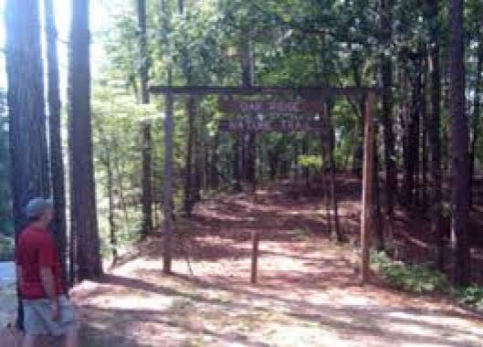
Oak Ridge Nature Trail - Carters Lake
Oak Ridge Nature Trail - Carters Lake
This trail begins near a parking area on the road to the camping area and follows a ridge to the lakeshore, then climbs up a ravine and continues to the start of the trail. Although relatively short, it offers a view at three distinct ecological communities, making this one of the most diverse trails for its length.
Trail Tree
This trail tree marks a route to the old Federal Highway that ran southeast of this point.
Carters Lake offers many undiscovered opportunities for outdoors enthusiasts. From good fishing and great skiing to hunting, the area around the lake is one of the last areas in the state to be "discovered." The lake was created from 1974-7 with the damming of the Coosawattee River. The creation of the lake destroyed one of the best whitewater runs in the nation.
The footpath begins climbing as soon as you pass the well-marked trail entrance. This section follows a 20th century logging road to the top of the hill, then follows the ridgetop. Even in the heat of summer there are a couple of good views of nearby Carter's Lake from the treadway. At .3 miles is a bench built to take advantage of one of these views.
From the bench the path continues along the ridge top, gently undulating towards the lower altitudes of the lake. As the ridge approaches the lake notice the change in the plant community. Both our dogs Taylor and Scout love to swim, so we give them a good ten minutes here. The water is clean and Carter's Lake doesn't have the problems of other north Georgia bodies of water. Lake levels can be widely varied as this is a watershed lake. Be careful if the lake level is low as it tends to expose the mistakes of local fishermen (e.g. old fishhooks).
After a brief lakeshore walk the trail begins to climb a ravine. This is the third ecological community. Although ample water exists, little grows at ground level because of the full overhead of trees that block the sunlight.
This portion of this easy-to-moderate trail is the only portion of the hike that can be considered moderate. After the climb to the top of the ravine is a strategically placed bench to welcome weary hikers.
The hike is completed passing near an old "Trail Tree" (pictured above). These trees were used by American Indians from the Great Lakes to the southern Appalachians to mark trail routes. This tree was probably created significantly after the last Cherokee left the area in 1838 on The Trail of Tears.